Aerial data collection
Qualified pilots deploy visual, thermal, LiDAR, or multi-spectral sensors to collect data on your assets — at the resolution your models need.
From aerial mapping and modeling to tracking and analytics, Visive AI software powers drones to deliver real-time data and autonomous action — visual, thermal, LiDAR, and multi-spectral.
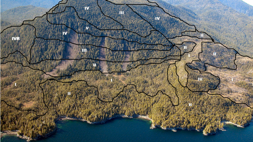
Artificial intelligence unlocks aerial data. Qualified pilots deploy sensors; customized AI interprets feeds into dashboards; drones then perform tasks independently based on that analysis.
Qualified pilots deploy visual, thermal, LiDAR, or multi-spectral sensors to collect data on your assets — at the resolution your models need.
Customized AI algorithms interpret collected data and deliver complete reports as operational dashboards your teams can trust.
Automate and authorize drones to perform tasks independently without manual intervention — driven by live data and analysis.
Beyond flight, computer vision lets intelligent machines perform visual data analysis and image-based functions. UAVs acquire and process high-quality visual data in real time so companies enhance operations on schedule — from livestock and topography to precision agriculture and process automation.
AI-supported drone platforms automate husbandry procedures such as Count Cow — cutting time and effort, and flagging unhealthy animals so teams intervene before losses grow.
Civil engineering needs impeccable topography. Visive AI drones record sites with 3D cameras and LiDAR; feeds become datasets for CAD 3D models of the real world.
Resource scarcity, climate pressure, labor gaps, and input costs demand better decisions. Visive combines drone automation, IoT, and AI so industrial farms and SMEs raise output and prevent crop damage.
Automate identification of defects that limit system function — infrastructure change detection and structural crack spotting at aerial scale.
Train drone models on large labeled photo corpora; upload image data quickly; detect situations specific to each mission.
Incorporate Azure cloud AI for UAV solutions — aligned with how civilian drone platforms partner with Microsoft.
Integrate Amazon drone-oriented cloud AI where it improves results for your fleet and analytics pipeline.
Python ML library for image processing — training drones to identify and understand objects after we analyze the mission domain.
Implement and validate algorithms used in AI-supported drone programming.
AI drones supervise procedures and act without manual commands — humans train, maintain, and monitor while revenue rises and errors fall.
Delivery across healthcare, manufacturing, retail, BFSI, and traffic — from PoC to hardened production.
Hundreds of skilled developers spanning cloud, ML, NLP, and computer vision.
Public and private clients who need security, reliability, and measurable ROI.
3D camera + LiDAR to CAD-ready maps
Terrain mappingAutomation hub for aerial and ground AI
Robots & dronesRun vision models on IoT edge devices
Edge analyticsDrones already appear across industries. As organizations automate, artificial intelligence drones play a vital role: controlling industrial processes requires machines that make decisions, and AI enables that autonomy. AI-equipped drones can be trained to supervise procedures and perform required operations according to conditions without manual commands — minimizing labor on the scene while humans focus on training, maintenance, and monitoring.
Automation of various processes saves time and effort and reduces error rates, because models are trained to monitor and operate procedures consistently. These smart devices help increase revenue while cutting the chance that a missed visual cue becomes an outage, a livestock loss, or a crop failure. Instant visual data analysis lets companies from many industries enhance operations and hit goals inside agreed timelines.
Visive integrates Google AI with TensorFlow for training on large labeled photo sets; Microsoft Azure cloud AI following civilian drone industry partnerships; and Amazon cloud AI where it improves fleet results. Open-source stacks — TensorFlow, PyTorch, and MATLAB — implement classification, perception, understanding, and discovery so drones take corresponding actions without human interference once policies are approved.
From animal husbandry management and topographic mapping to precision agriculture, change detection, and crack detection, Visive’s AI-supported smart solutions help companies automate previously manual aerial workflows with dashboards that turn sensor floods into decisions.
Qualified pilots deploy the right sensor mix for each asset class. Customized algorithms interpret the flood of frames and point clouds into complete operational reports. Authorization policies then let drones perform follow-up tasks independently when analysis confirms a condition — a closed loop from sky to decision. Livestock programs cut census time; terrain programs feed CAD; agriculture programs raise yield decisions; infrastructure programs catch cracks and change before they become failures. That is how Visive unlocks aerial data with artificial intelligence instead of leaving it as unused video.